
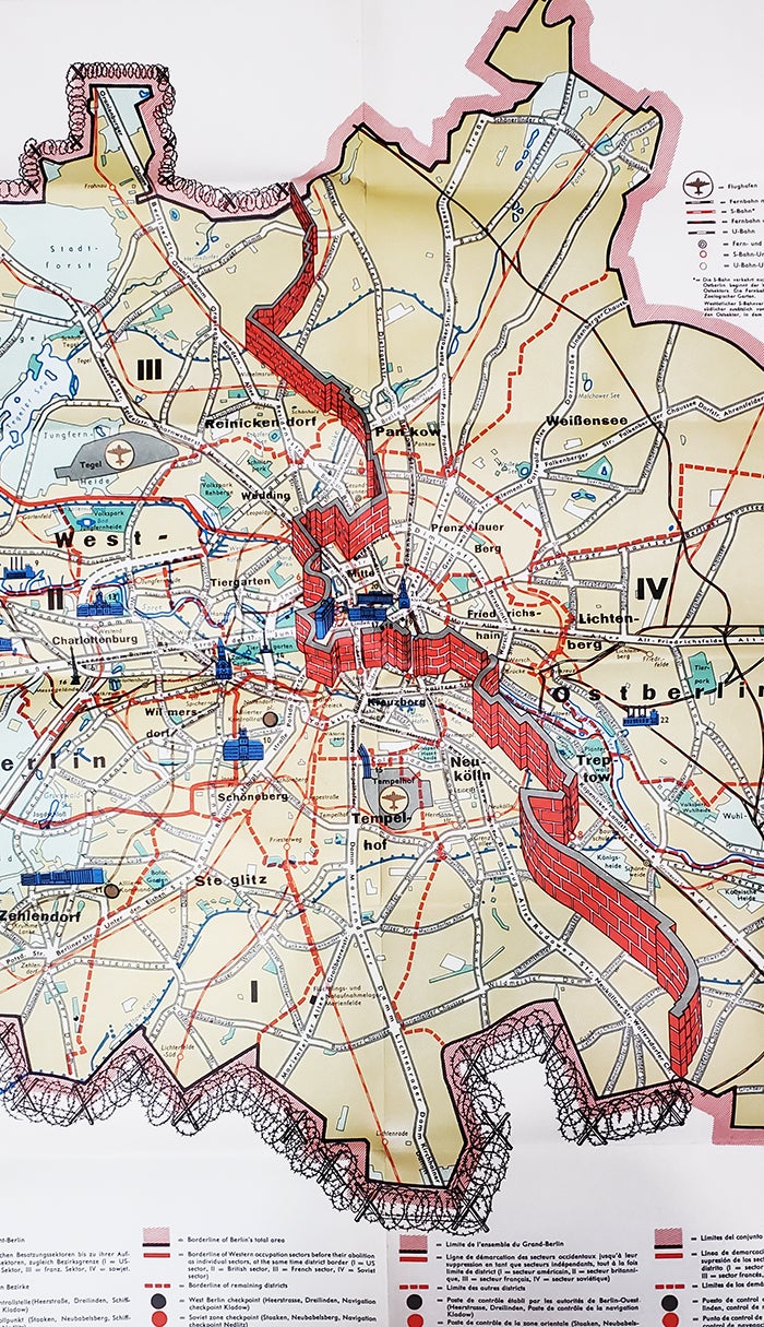
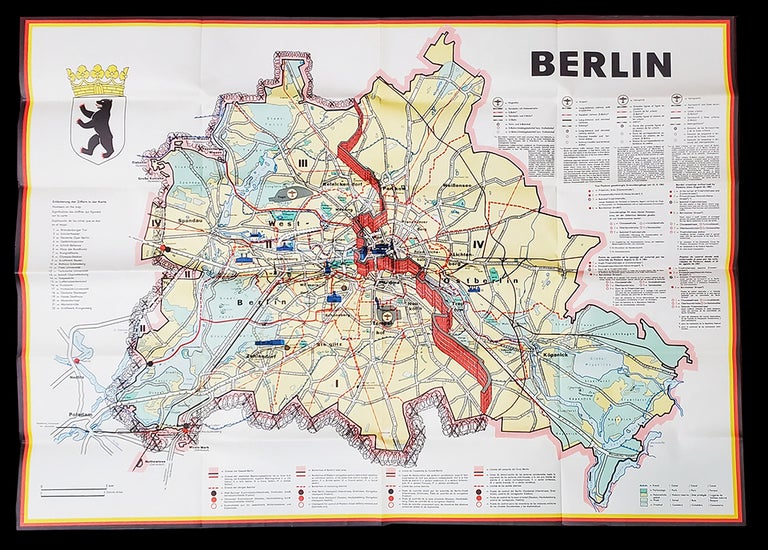
Berlin JRO-Sonderkarte. (Folding Map of Berlin Showing the Berlin Wall).
Berlin: Presse- und Informationsdienst des Landes Berlin, 1962. Ephemera. Item #34928
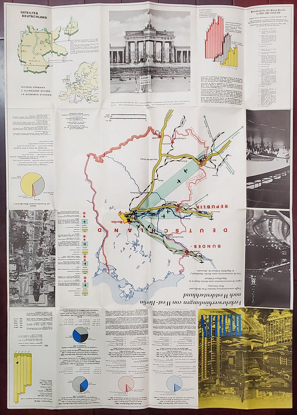
Aktuellen JRO-Landkarte Nr. 167. By Prof. Dr. G. Fochler-Hauke and Dr. Ernst Kremling. Folding map showing the city of Berlin divided by a red wall and West Berlin enclosed in barbed wire. Scale is approximately 1:68,000. Map measures 81 x 58 cm open and 10 x 21 folded. Text in German, English, French, and Spanish. Includes index for significant buildings and monuments, legends for roads, boards, and other transportation, and a color emblem of the city. The verso has graphs and ancillary maps with data on goods supplied and purchased by West Berlin, air traffic arrivals and departures between 1956 and 1960, percentage of tourist traffic to West Berlin, Federal subsidies and other Federal grants, Federal aid for West Berlin 1950 to 1960, and more. The map is in fine condition and appears unused.
Price: $250.00